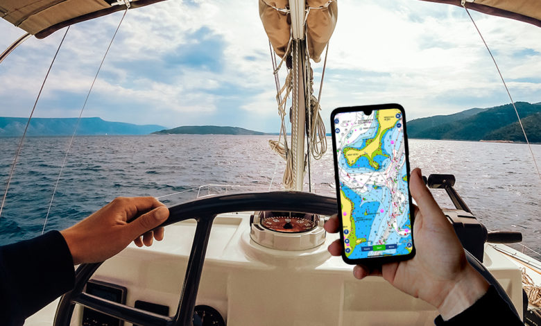
Gone are the days of getting hassled using old-school paper maps, inaccurate analog compass, and expensive gps trackers- our smartphones have become a handy all-in-one chart-plotter that makes our boating journey a thousand times more chill.
This article is a comprehensive review of 5 apps based on critical features needed for navigation and our own take on them, plus a comparison of each to help you decide which one to finally install.
Quick Overview
| Feature | Navionics | C-MAP | iSailor | SeaPilot | iNavX |
|---|---|---|---|---|---|
| Real Time Positioning | ✔️ | ✔️ | ✔️ | ✔️ | ✔️ |
| Route Tracker | ✔️ | ✔️ | ✔️ | ✔️ | ✔️ |
| Route Planning | ✔️ | ✔️ | ✔️ | ✔️ | ✔️ |
| Incorporate Data on Route Planning | ✔️ | ✔️ | ❌ | ❌ | ✔️ |
| AIS Live | ✔️ | ✔️ | ✔️ | ✔️ | ✔️ |
| Download Chart and Offline Use | ✔️ | ✔️ | ✔️ | ✔️ | ✔️ |
| Data Overlay | ✔️ | ✔️ | ✔️ | ✔️ | ✔️ |
| Import/Export/ Data Synchronization | ✔️ | ✔️ | ✔️ | ✔️ | Only Import/Export Cannot sync to other devices |
| Weather Forecast | ✔️ | ✔️ | ✔️ | ✔️ | ✔️ |
| User Interface | Easy | Easy | Moderate | Easy | Difficult |
| Cost | Free App with a two-week free trial, then subscriptions starting at $14.99 US. | Free App with a two-week free trial and annual premium subscription at $60 US. | Free App but other features only accessible with subscription, charts are paid starting at $4 US. | Free App but other features only accessible with premium subscription at $ 39.99 US and charts are paid. | Free App with NOAA Chart in the US, but needs to purchase other charts at different prices. |
🥇 Over-all Champion: Navionics
🥈 Most User-Friendly Award: C-MAP
🥉 Best Value for Money Award: iSailor
Top Priority Features
While there can be a number of functions users may find interesting, we carefully identified the top 10 features that can make or break an app. These factors will highly contribute to the usefulness while on an actual trip, ability to provide information that can better prepare the you for your journey, safety, data management and affordability.
- Real time positioning – exactly locate yourself on a chart using GPS. Useful in estimating distance from a point or simply knowing exactly where you are and not get lost.
- Route Tracker – start and stop record the track taken using GPS and display it on the chart. Gives Course over Ground (COG) and Speed over Ground (SOG). Log, review and export data for record keeping and future use.
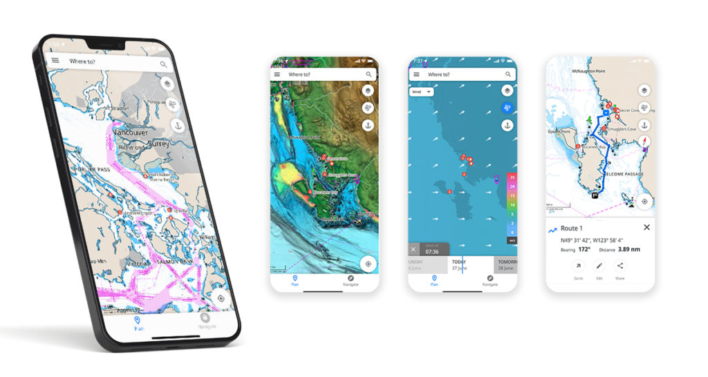
- Route Planning – to create a path on a chart that can be followed using GPS, usually calculates distance between two or more points, ETA from point A to B, fuel needed. Useful before (to prepare necessary things) and makes navigation a lot easier. Just follow the arrow!
- Route Planning Incorporating Other Data – Modify cruising speed, ETA and fuel needed based on the live atmospheric/weather data, usually wind speed and direction.
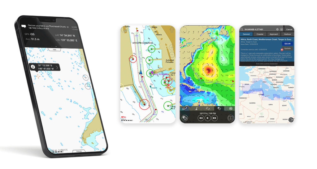
- AIS Live – Use data (from other users or providers) to plot boat traffic and other activities on the chart, think about Waze. Increases situational awareness and safety.
- Download charts and Offline use – store a portion or the entire chart on your phone and use a number of features of the app even while offline, very useful at the middle of the sea where mobile data is unavailable.
- Chart Options and Data Overlay – Apply one or several layers of charts and data to show on the chart, e.g. depth, satellite, NOAA, wind direction, etc.
- Import/Export Data/ Data Synchronization – Download and upload waypoints, routes, tracks and use in other apps and softwares, sync data purchased to other devices like iPad, tablet and laptop.
- Weather Forecast – View changing wind speed and direction, precipitation, tides, and current data.
- Interface/User Friendliness – How easy is it to use for recreational boaters or more advanced users.
Many navigation apps can be downloaded for free and a lot of them have features that are accessible without a cost. However, in order to maximize their features such as unlocking AIS Live, weather forecast, downloading charts for offline use, a premium subscription is usually needed.
Some apps would allow users to use their phones’ GPS system to access basic functions such as real-time positioning, route tracking, even route planning at no cost, but these would usually require paying for the chart itself.
In general, these apps are very inexpensive (most of them less than $50 annually!), considering all the benefits we can get from them like saving dollars on unnecessary fuel consumption because of longer routes or the cost of repair in cases of accidents, and of course, our safety is priceless!
What is NMEA and is it really necessary?
NMEA stands for National Marine Electronics Association, this allows us to integrate electronic devices such as GPS, Sonar, radar, VFS radion and even boat speedometer, engine thermometer, oil pressure gauge, weather instruments, etc. In simpler terms, it lets our devices talk to each other.
Now the question is, is NMEA a must-have for boat navigation? While NMEA is undoubtedly useful in managing data we get from these separate devices, many recreational/small boats do not necessarily have a lot of sensors installed in them to the point that it’s unmanageable, so not having NMEA will not be a big issue for recreational boaters.
Some applications listed here do not have the NMEA integration feature but anyhow serve their purpose pretty well. You can still locate yourself, create a route, record your track, access weather forecasts, and most importantly, arrive at your destination safely even without it.
Charts or Maps?
All charts are maps but not all maps are charts. A map is a general term referring to a flat drawing of the Earth, or an area of it, let’s say a country. There are road maps that show networks of roads and passages, or topographic maps that show elevation. Meanwhile, there are also specialized maps that show great details of the bodies of water including depth or the water’s edge or any danger for navigation, these are called charts. Charts are what we need for boating!
Nautical Charts – Key to safe navigation and every boater should be familiar with. Through it, we will know the water depths, locations of dangers to navigation, locations and characteristics of aids to navigation, anchorages, and other features. Many, if not all, boating apps use this to let boaters plan the best route safely and economically.
Other Charts/Maps – Some apps would have more charts that you can use other than just nautical charts. Examples are satellite maps that show realistic images of the Earth’s surface, or Sonar imagery, which creates extraordinary bottom contour generated from water soundwaves.
Free vs. Paid? The amount of open-sourced data available helps the number of free charts grow, allowing many boaters to avoid spending extra on charts from big companies that make them, but remember that subscribing to these providers allows us to continuously get updates as well as ensure accuracy and reliability that we might not get from free sources.
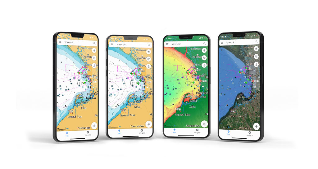
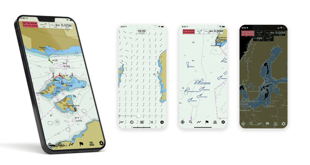
 Navionics Boating Marine & Lakes
Play/App Store Rating: 4.6⭐ No. of Downloads: 1.5M+
Cost: Free App with a two-week free trial, then subscriptions starting at $14.99 US.
Critical features
- Real time positioning
- Route Tracker
- Route Planning
- Incorporate Data on Route Planning
- AIS Live
- Download charts and offline use
- Data overlay
- Import/Export Data/ Sync Data
- Weather Forecast
- User Friendly
Bonus Features
- Pan around and seamlessly zoom in and out
- Uses official unaltered NOAA charts
- Nautical and Sonar Charts that can be customized
- Multiple devices synchronization
- Auto-routing with dock-to-dock plans
- Easy-to-interpret, clearer view of bottom structure with Relief Shading and Sonar Imagery
- Marinas, mooring, fuel station, etc.
Wishlist
- More customization features for more advanced boater
- NMEA Integration expanded
Our verdict?
Well-designed and reliable, especially to recreational boaters who prefer simplicity and ease of use, the only downside is there’s not so much room for personalization. For accessing different charts including Sonar and NOAA, plus many advanced features such as auto-routing and data on marinas, mooring, fuel station, etc., the app subscription is relatively cheap.
![]()
![]() or visit Navionics website
or visit Navionics website
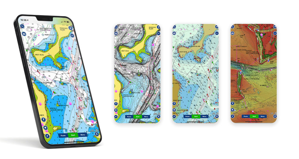
 C-MAP
C-MAP
Play/App Store Rating: 4.5⭐ No. of Downloads: 500K+
Cost: Free App with a two-week free trial and annual premium subscription at $60 US.
Critical features
- Real time positioning
- Route Tracker
- Route Planning
- Incorporate Data on Route Planning
- AIS Live
- Download charts and offline use
- Data overlay
- Import/Export Data/ Sync Data
- Weather Forecast
- User Friendly
Bonus Features
- Easy view that
- Long press to add a waypoint
- Worldwide chart personalization
- Contour customization
- High accuracy weather forecast
- High Resolution Bathymetry
- Auto-routing
Wishlist
- Fuel consumption estimate on plan
- Incorporate boat specs
- NMEA Integration
Our verdict?
Very intuitive and easy to use with all the features needed by a boater for navigation. Value for money at US $60 that will let you plan trips more safely by increasing your situational awareness including high accuracy weather, AIS and high resolution bathymetry, and download charts to use offline.
![]()
![]() or visit C-MAP website
or visit C-MAP website
 iSailor
Play/App Store Rating: 3.4⭐
Cost: Free App but other features only accessible with subscription, charts are paid starting at $4 US.
Critical features
- Real time positioning
- Route Tracker
- Route Planning
- AIS Live
- Download charts and offline use
- Data overlay
- Import/Export Data/ Sync Data
- Weather Forecast
- User Friendly
- Incorporate Data on Route Planning
Bonus Features
- Displays just right amount of information
- NMEA Integration
- Different features can be bought separately (save money)
- Weather forecast is downloadable
- Cheapest app that we’ve tested
Wishlist
- Availability on Google Play
- Simpler route planning
- Integrate weather data in planning routes
Our verdict?
Being only available on App Store, Android users can now eliminate this app. Although, it is important to note that this is the cheapest app among all that we’ve tested. As it doesn’t have data integration on route planning, it’s NMEA compatibility is not actually maximized. Its interface is also better for iPad/tablet than smart phones.
![]() or visit iSailor website
or visit iSailor website
 Seapilot
Play/App Store Rating: 3⭐ No. of Downloads: 100K+
Cost: Free App with but other features only accessible with premium subscription at $39.99 US and charts are paid separately.
Critical features
- Real time positioning
- Route Tracker
- Route Planning
- AIS Live
- Download charts and offline use
- Data overlay
- Import/Export Data/ Sync Data
- Weather Forecast
- User Friendly
- Incorporate Data on Route Planning
Bonus Features
- Easiest creation of waypoints and showing enough information
- NMEA connection available
- Chart customization
- View several routes at a time
- Auto-routing
Wishlist
- Zooming out
- Select areas to download to save memory
Our verdict?
Comprehensive navigation app providing necessary features for navigation on premium subscription. Making waypoints on this app is the easiest among all that we’ve compared. As it is NMEA compatible, data from the boat can be integrated to the app.
![]()
![]() or visit Seapilot website
or visit Seapilot website
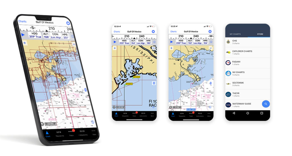
 iNavX
iNavX
Play/App Store Rating: 4.4⭐ No. of Downloads: 100K+
Cost: Free App with NOAA Chart in the US, but needs to purchase other charts at different prices.
Critical features
- Real time positioning
- Route Tracker
- Route Planning
- Incorporate Data on Route Planning
- AIS Live
- Download charts and offline use
- Data overlay
- Import/Export Data
- Weather Forecast
- User Friendly
Bonus Features
- Highly customizable with charts from different providers
- Customizable display
- Variety of charts that can be unavailable on other apps
- NMEA compatibility that provide extensive data
Wishlist
- Friendlier user interface as navigating the app can be challenging
- Synchronize with different devices to use purchased charts
Our verdict?
Difficult user interface but highly customizable, recommended to more advanced boaters. Various charts available on purchase, which can be an advantage for those areas where charts are difficult to access, but note that you need to purchase them again whenever using a new device. It is also NMEA compatible with extensive data that can be integrated to the app.
![]()
![]() or visit iNavX website
or visit iNavX website
Whether you’re just a beginner or already a seasoned boater, it is now almost impossible to start our engines without installing at least one app on our smartphones (others even couldn’t without a backup!). Are you ready to try these apps? Let us know what you think of them by leaving a comment below!
Google Play and the Google Play logo are trademarks of Google LLC.
Apple logo® and App Store® are trademarks of Apple Inc., registered in the U.S. and other countries.