Boating navigation is no different from driving cars. Just as we have road signs and traffic lights that we strictly follow on land, there are also internationally recognized signs and signals, in the form of buoys, marks and flags that prevent us from damaging our vessels, and worse, putting ourselves in danger on the water.
To be more familiar with these, we have included in this article an introduction to the systems of navigation as well as images, purposes, and descriptions of buoys and marks. We also have a 2-page PDF that you can download and print for free, so you can have a hand-carry guide when you finally start your journey! Nautical flags and the International Code of Signals are also discussed thoroughly.
Until the 70s, there was no single authority that implemented rules of navigating maritime waters, which caused confusions and lots of accidents, and only in the 80s that the International Marine Aids to Navigation and Lighthouse Authorities or IALA was established. Currently, there are two systems used by boaters around the world, the IALA Region A, that is being used in Africa, most of Asia, Australia, Europe and India, and the IALA Region B, in North, Central and South America, Japan, Korea and the Philippines.
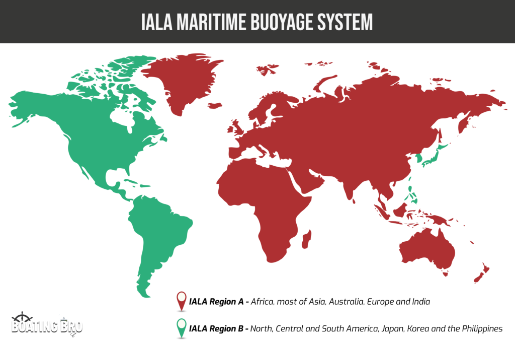
There are very few differences between the two systems, in fact, they are almost identical, except that IALA Region A port (left) lateral marks and lights are colored red and starboard (right) lateral marks and lights are colored green, while it’s the opposite in IALA Region B.
I personally carry around one of these Davis Navigation reference cards in all my boats. For $17 it’s priceless piece of mind when on the water with spotty internet.
Definition of Terms
Port – Left side of the boat
Starboard – Right side of the boat
Channel – Body of water between two close landmasses, e.g. river, strait, harbor
Fairway – Navigational area of a channel
Bifurcation – Point where at which a channel branches into two
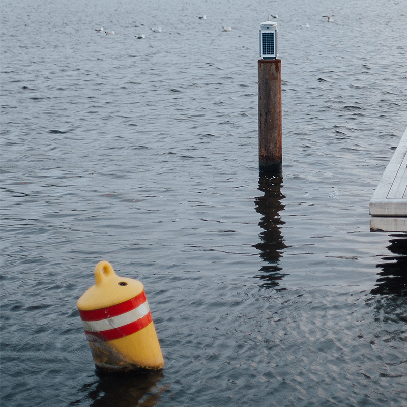
Buoy – floating navigation aid in the water
Marks – fixed navigation aid in the water
Mooring – Point of anchorage
Light Flashing – Series of light flickers with different meaning
- Day time – through the color, shape, top-mark, marks, and/or light (including color and rhythm).
- Night time – through the color and rhythm of light and/or illumination enhancement.
- By electronic (digital) symbology – e.g. as a complement to physical marks.
Marks vs. Buoys
Marks and buoys are navigational aids in the water that come in different colors, shapes, and markings, used to help boaters in choosing which direction to go and areas to avoid, or to provide important information to ensure everyone’s safety in the area, whether on board or not.
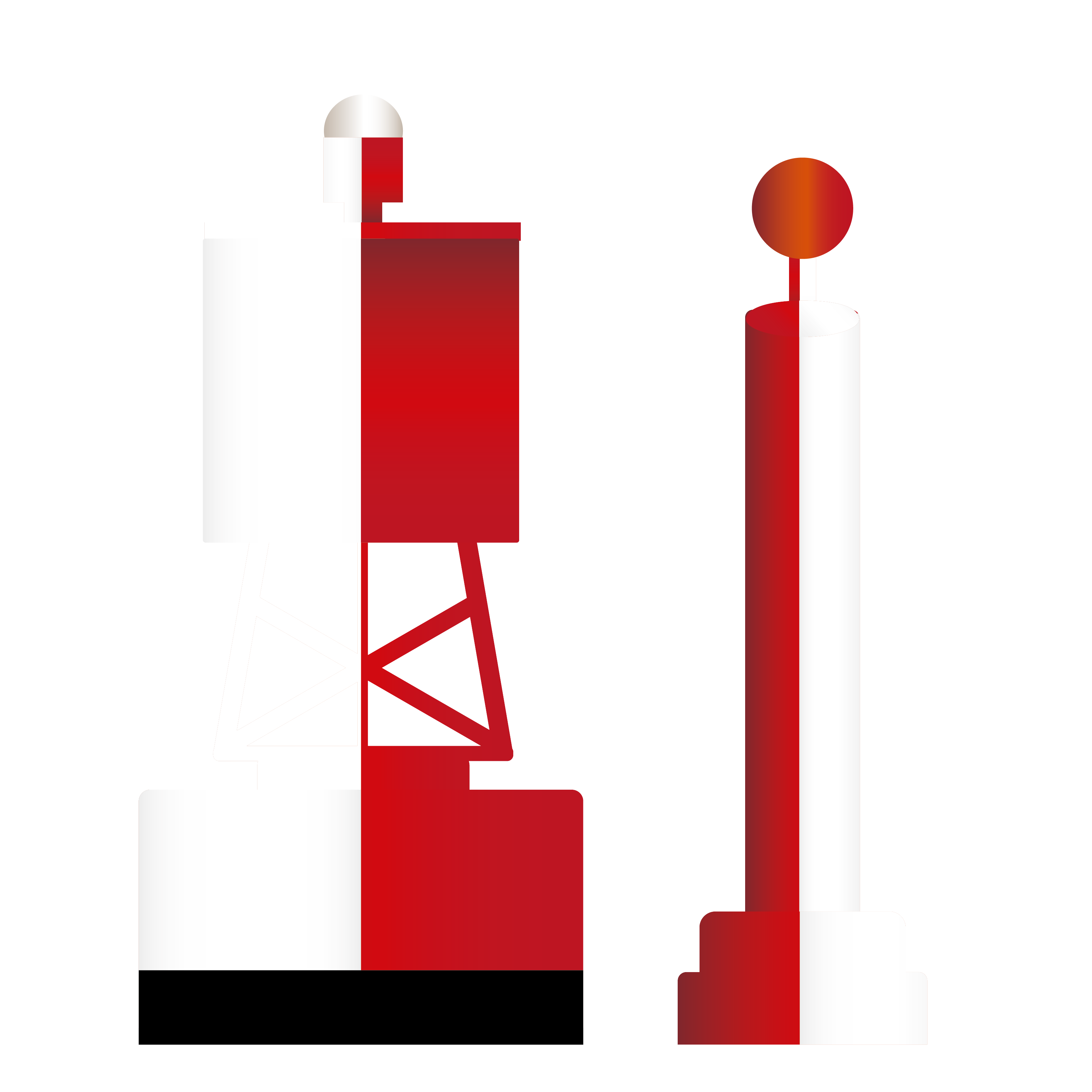
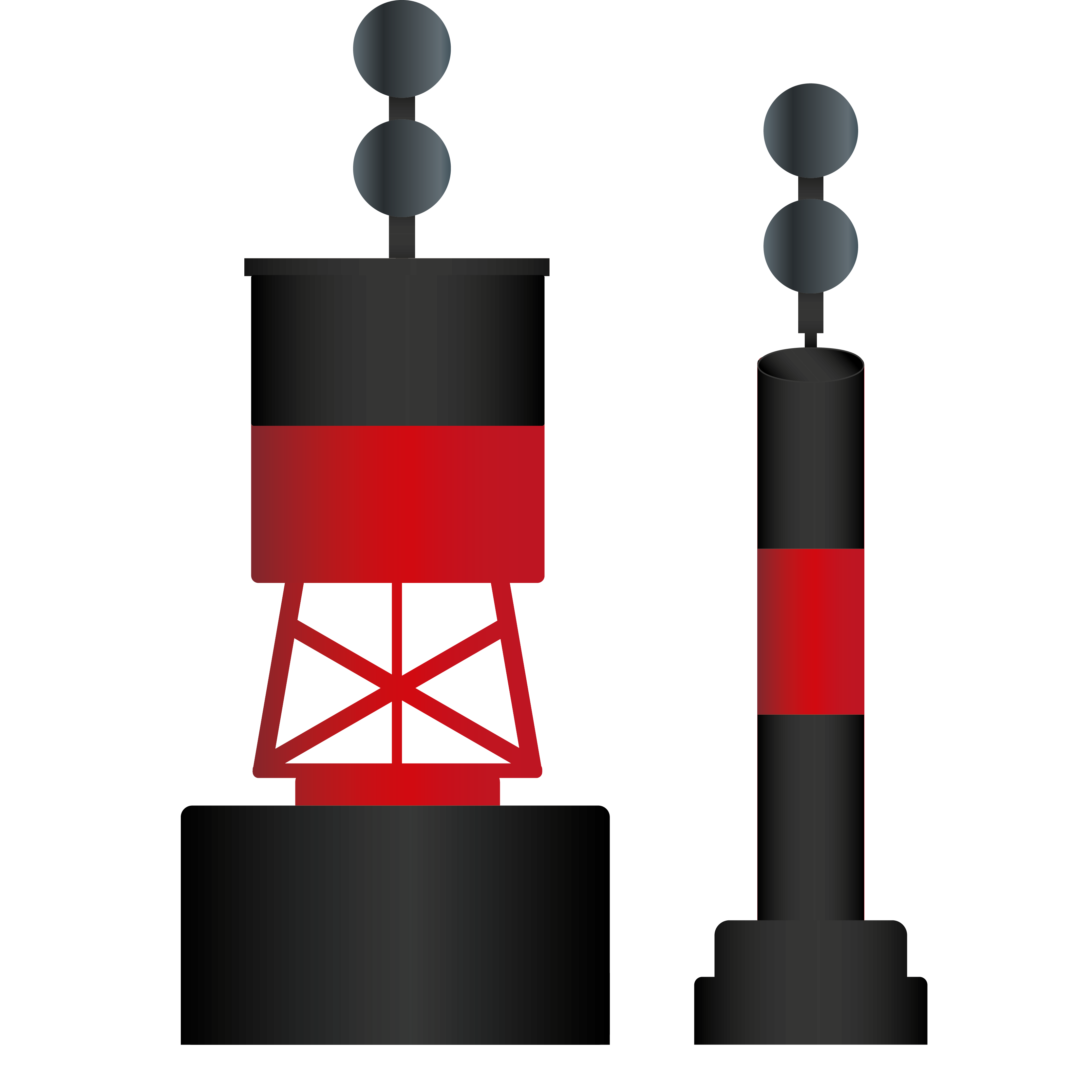
Marks are fixed aids usually on poles and pilings while buoys are floating aids that are anchored to the bottom. In areas where it’s shallow enough to drive a piling, marks are usually preferred as they do not require as much regular maintenance. On the other hand, in deep waters where it’s difficult to drive a piling, putting a buoy makes more sense. Also, in places where channels may shift and change over time, placing a buoy that is movable and can be anchored is the more common practice.
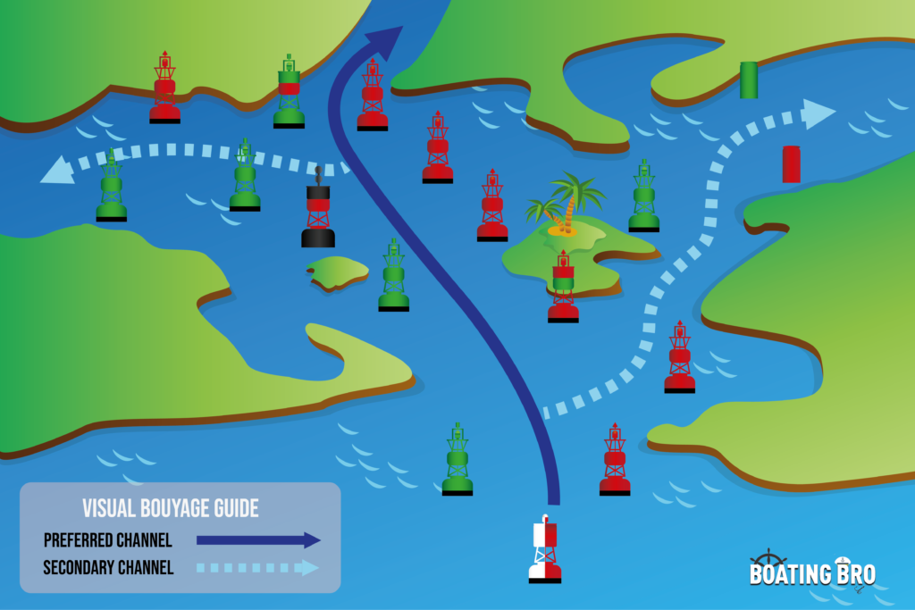
Lateral Buoys/Marks
Lateral buoys/marks indicate which side of the buoy is the safest to follow when in a channel. There are four kinds of lateral buoys that differ in color, namely port hand, starboard hand, port bifurcation, and starboard bifurcation.
| Lateral Buoy | Port Hand Buoy/Mark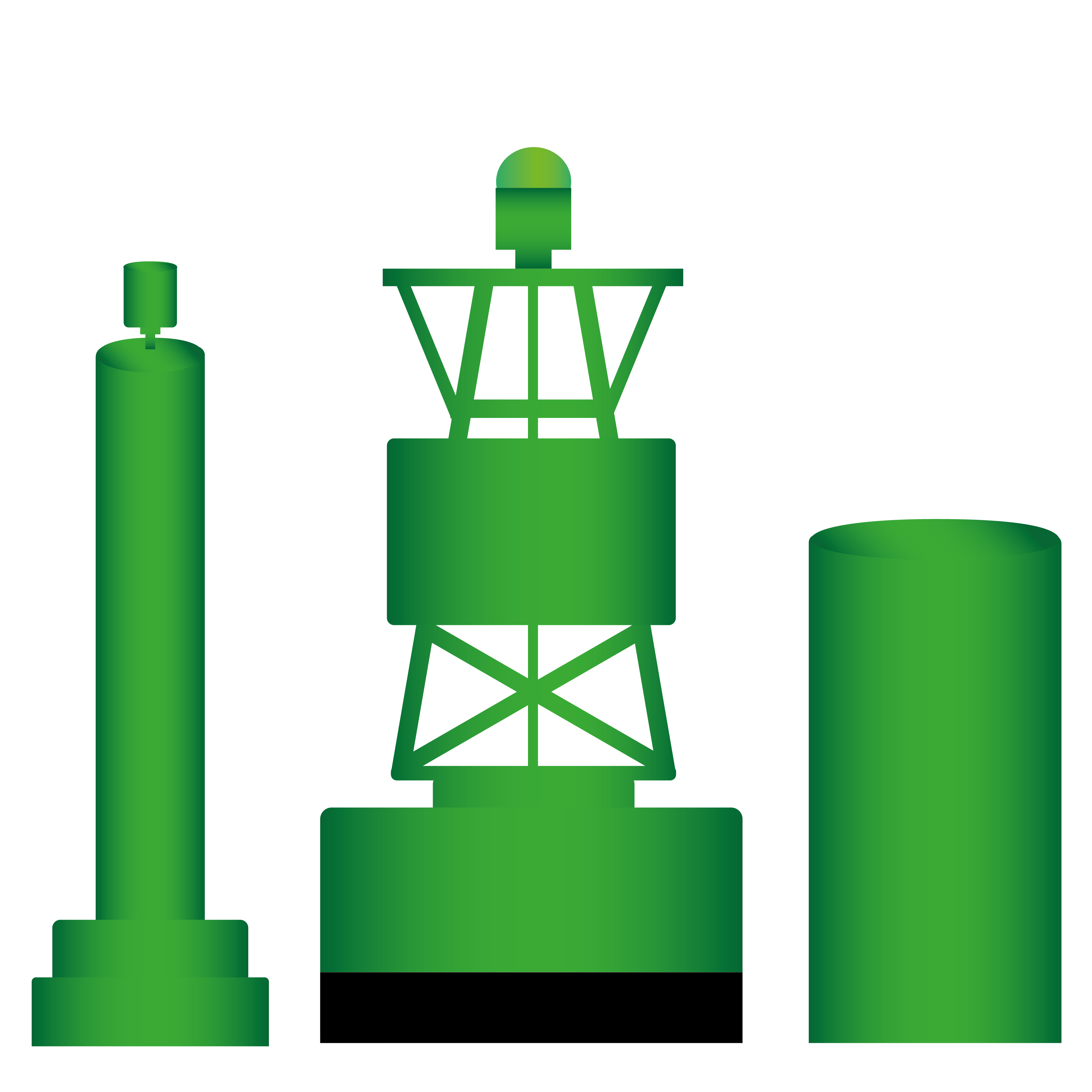 | Starboard Hand Buoy/Mark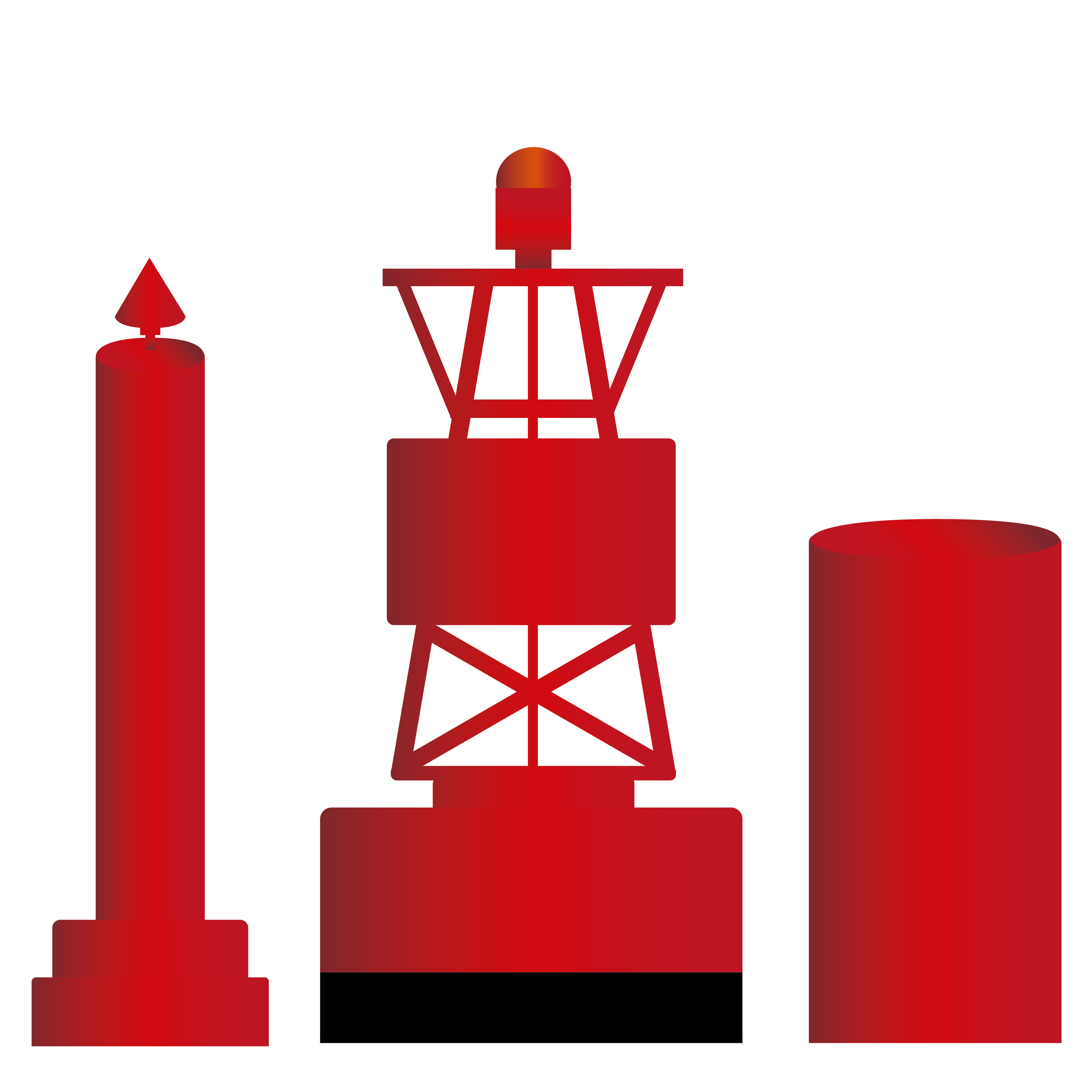 | Port Bifurcation Buoy/Mark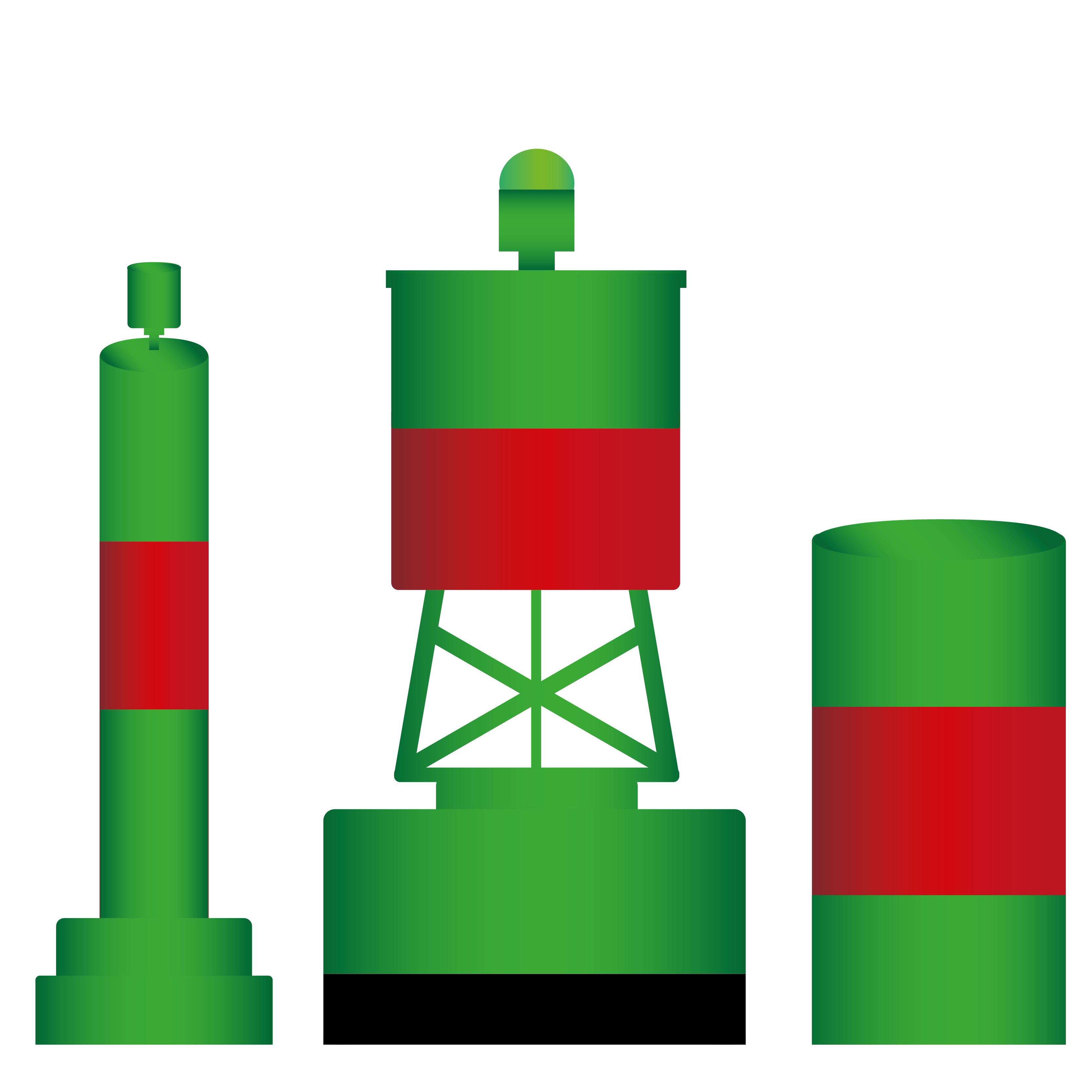 | Starboard Bifurcation Buoy/Mark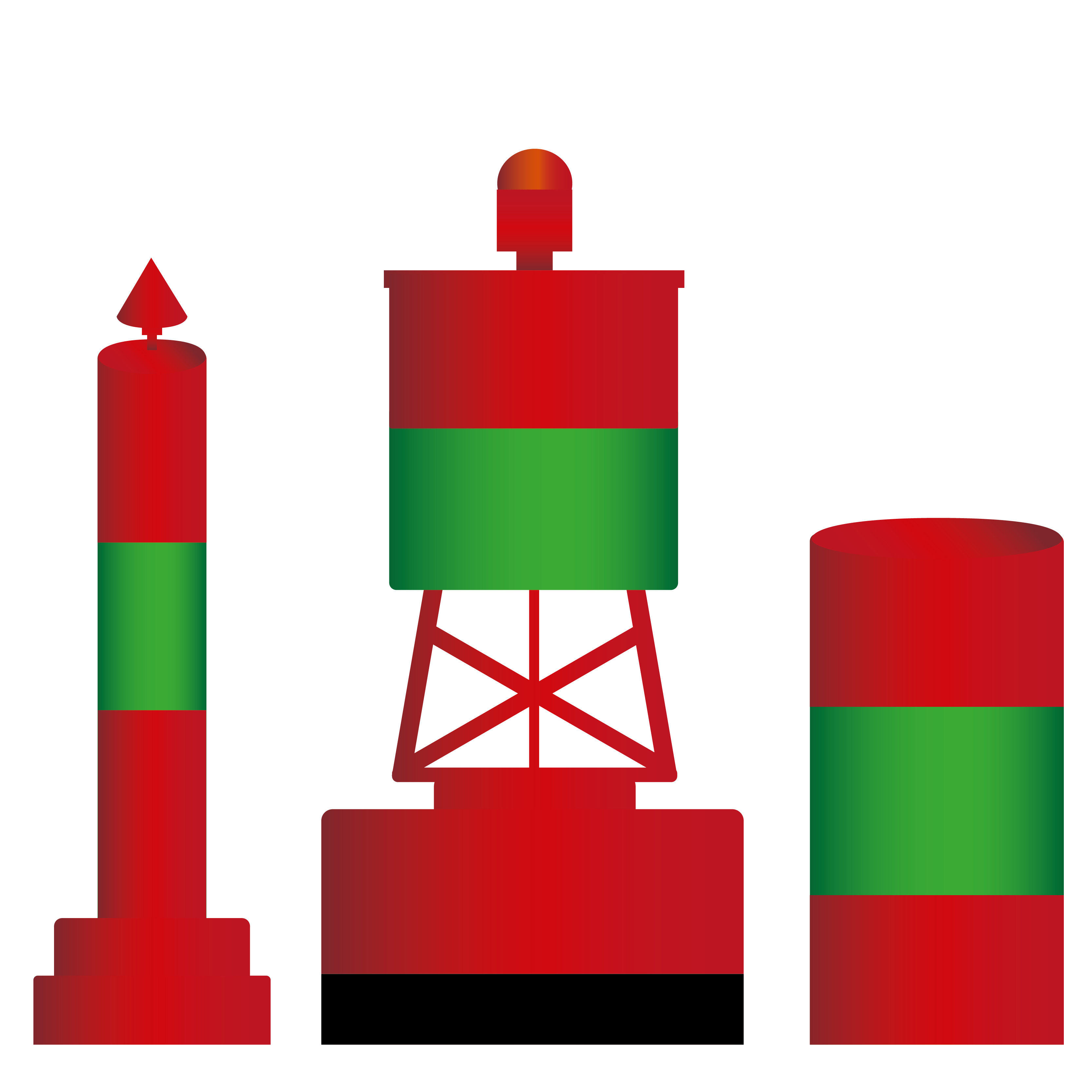 |
|---|---|---|---|---|
| Meaning | Marks out the port side of passage way or channel | Marks out the starboard of passage way or channel | Marks where channel splits and to proceed with the channel on the right | Marks where channel splits and to proceed with the channel on the left |
| Keep on this side of the boat | Left if traveling upstream | Right if traveling upstream | Left if traveling upstream | Right if traveling upstream |
| Color | Green; Retroreflective | Red; Retroreflective | Green with single red horizontal band; Retroreflective | Red with single green horizontal band; Retroreflective |
| Body Shape | Cylinder, pillar or spar | Cylinder, pillar or spar | Cylinder, pillar or spar | Cylinder, pillar or spar |
| Top Mark | Single green cylinder | Single red cone pointing upward | Single green cylinder | Single red cone pointing upward |
| Light Color | Green | Red | Green | Red |
| Light Rhythm | Flashing or quick | Flashing or quick | Group flash (6s or 10s) | Group flash (6s or 10s) |
| Markings | odd numbers | even numbers | letters | letters |
When it’s dark and we cannot rely on the colors of the buoys, light signals are our most efficient aid to navigate. When equipped, lights are usually placed on top of buoys. These lights would have different flashing frequencies and colors.
Different flashings can be characterized as follows:
Flashing – Flashes light every 4 seconds 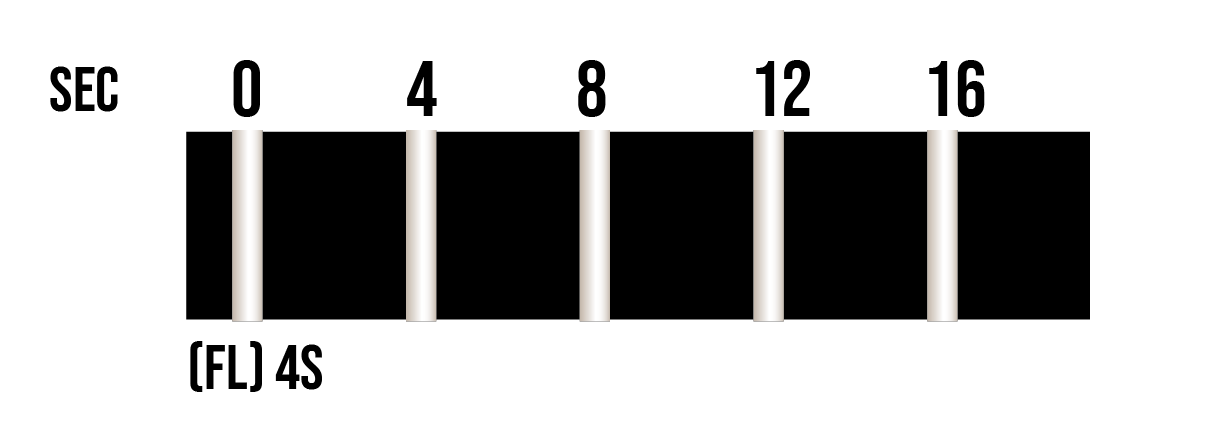
Group Flashing (6s) – 2 consecutive flashes, pause, 1 flash and a pause in 6 seconds 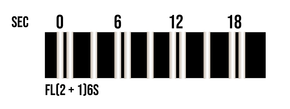
Group Flashing (10s) – 2 consecutive flashes, pause, 1 flash and a pause in 10 seconds 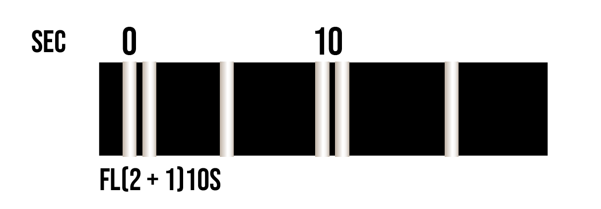
Group Flashing (2s) – 2 consecutive flashes and a pause 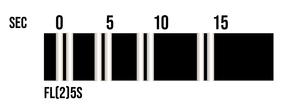
Quick Flashing – 1 flash every second 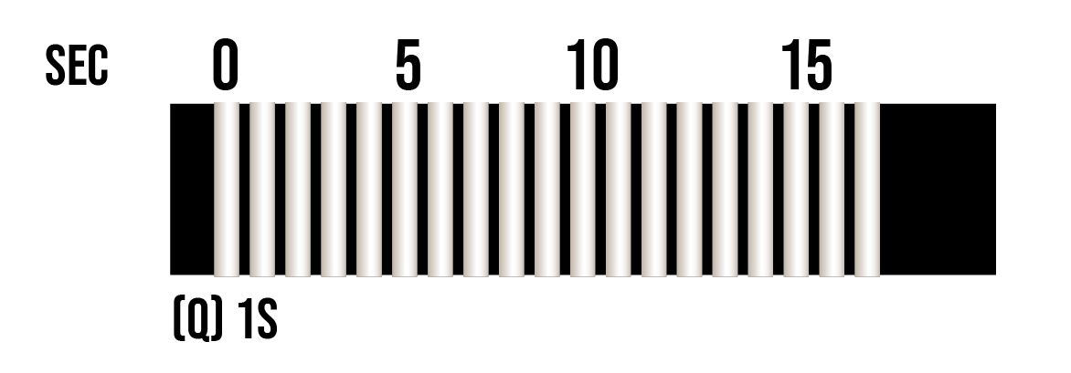
Very Quick Flashing – 2 flashes every second 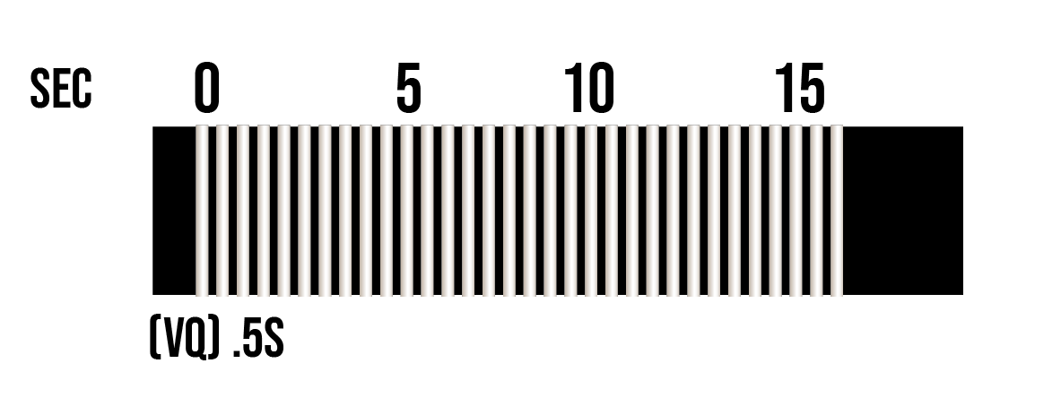
Safe Water or Fairway Buoy
- Marks entrance to channel, channel centers and landfall locations
- Always keep on the left side of the boat
- Red and white in color Retroreflective
- Cylinder, pillar or spar in shape
- Round top mark if present
- White light if present
- Light rhythm: group flash (6s or 10s)
Isolated Danger Buoy
- Marks dangers that must be avoided like submerged rocks or wrecks which may increase in distance
- Usually placed right above the danger
- Black with one or more red horizontal bands in color
- Retroreflective
- Pillar or spar in shape
- Two sphere disposed of vertically top mark if present
- White light if present
- Light rhythm: group flashing (2s)
For a clearer visualization of buoys and marks in the channel, here is a map that shows where they will be located while traveling upstream.
Cardinal Buoys
Cardinal buoys also mark which side of the buoy is safe to travel, however, instead of going left and right, they tell us whether to go north, south, east or west. Similar to lateral buoys, they are pillar or spar shaped. They are black and yellow in color and sometimes equipped with white light.
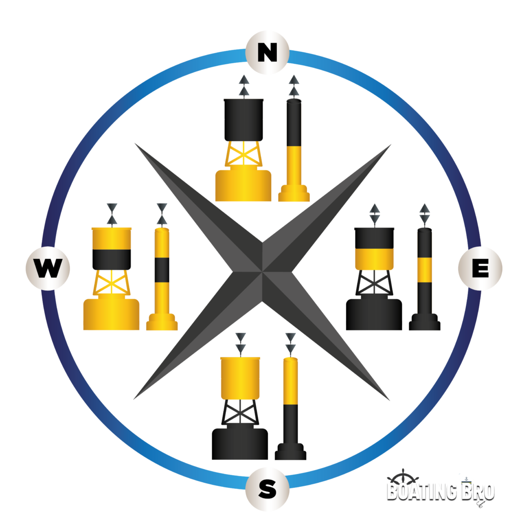
| Cardinal Buoy | North | South | East | West |
|---|---|---|---|---|
| Keep on this side of the boat | North side | South Side | East Side | West Side |
| Color | Black above yellow | Yellow above black | Black with a single yellow band | Yellow with single black band |
| Top mark | Two cones pointing upward | Two cones pointing downward | Two cones pointing opposite directions | Two cones pointing towards each other |
| Light rhythm | Quick (Q) or very quick (VQ) | 6 VQ + long flash or 6 Q + long flash | 3 VQ or 3 Q | 9 VQ or 9Q |
Special Buoys
Special buoys mark an area for a specific purpose. They usually have no designated shape and with yellow light when equipped. Some special buoys are not labelled, while some are, and if it is, the mark is never a number.
Anchorage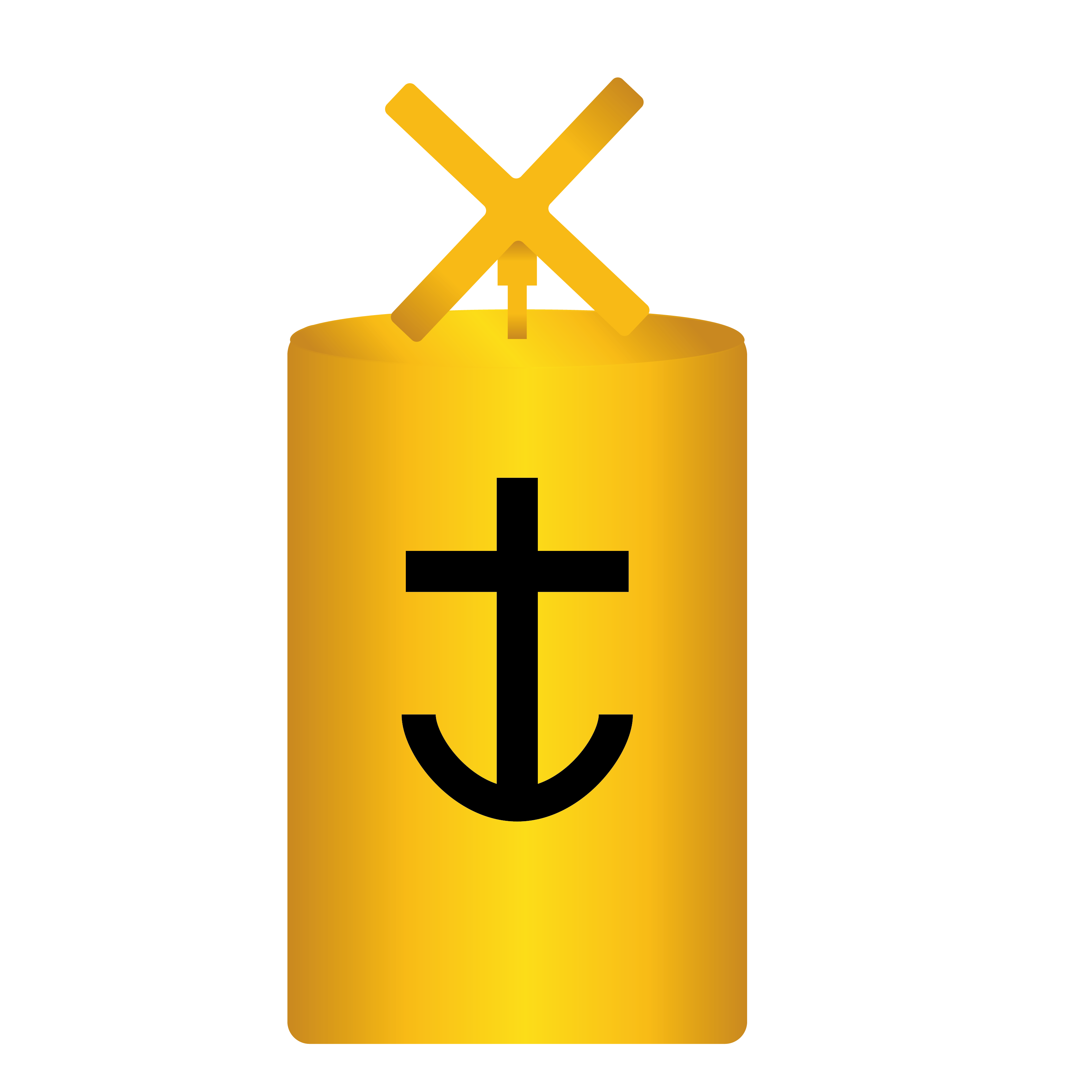 | Cautionary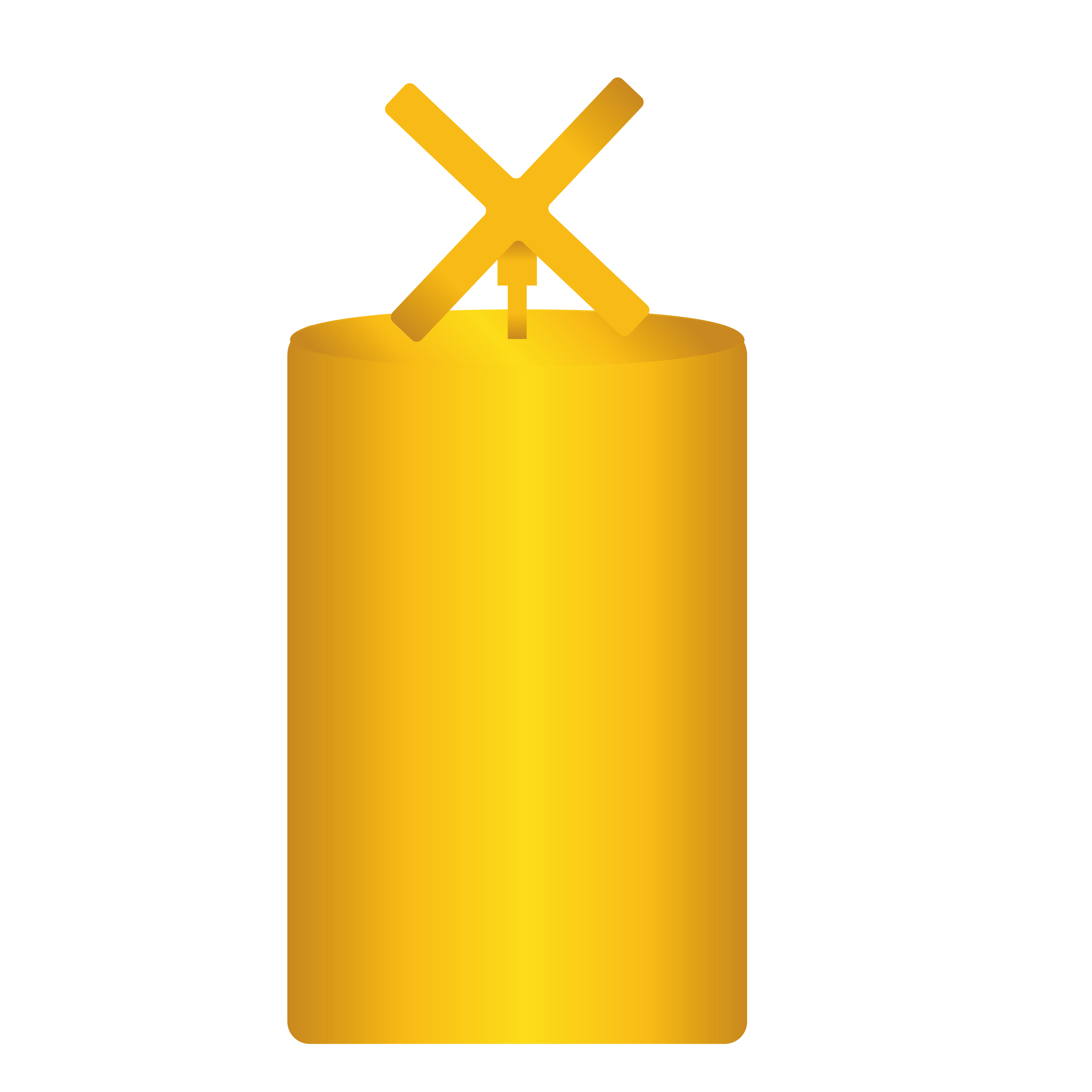 | |
|---|---|---|
| Meaning | Marks a designated area where you can anchor your boat | Marks a danger and general boating is not permitted could be underwater pipeline, a firing range or seaplane base |
| Color | Yellow; retroreflective | Yellow; retroreflective |
| Body Shape | Cylinder, pillar or spar | Cylinder, pillar or spar |
| Top Mark | Cross if present | Cross if present |
| Light | Yellow on any rhythm not used for white light | Yellow on any rhythm not used for white light |
| Marking | With anchor symbol on the body | Marked with letters on the body if present |
Control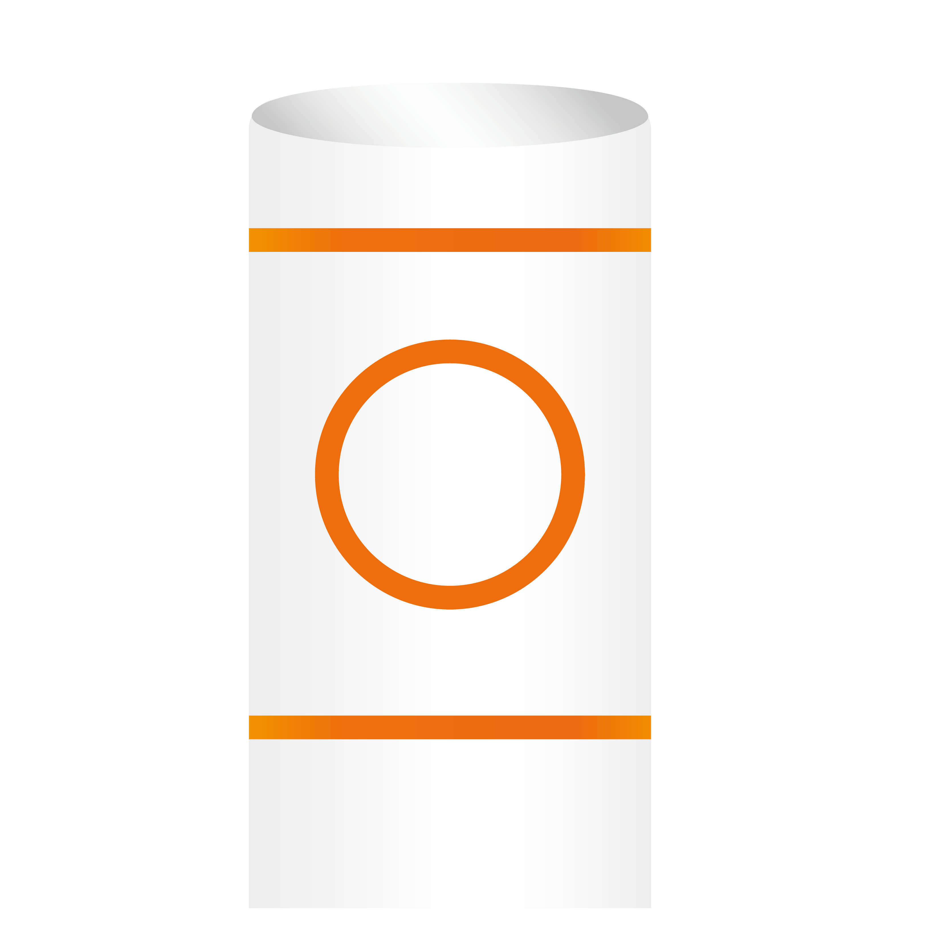 | Hazard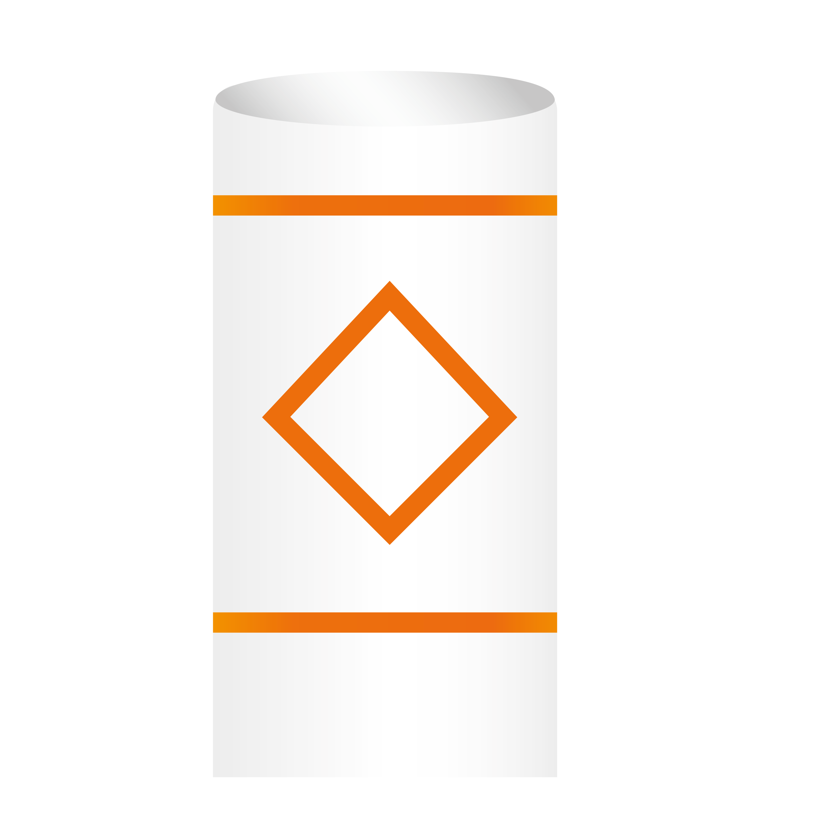 | Information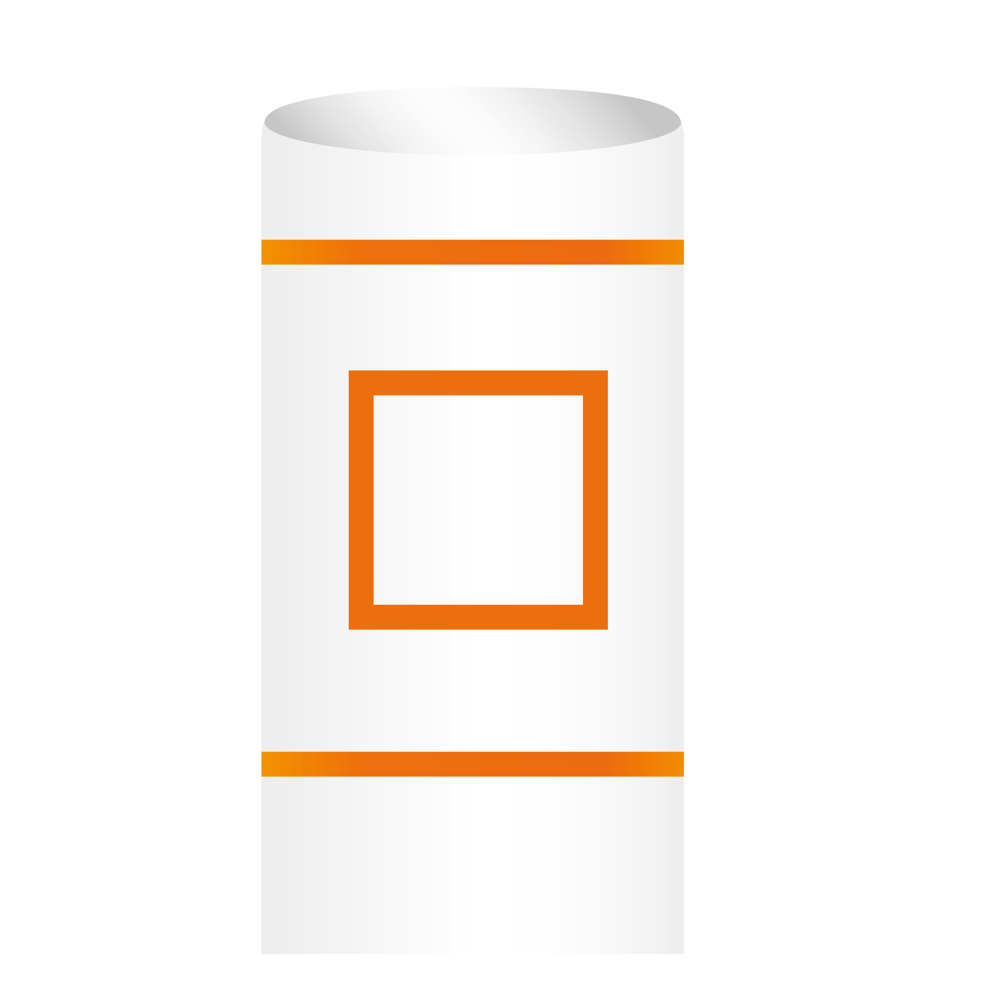 | No Trespass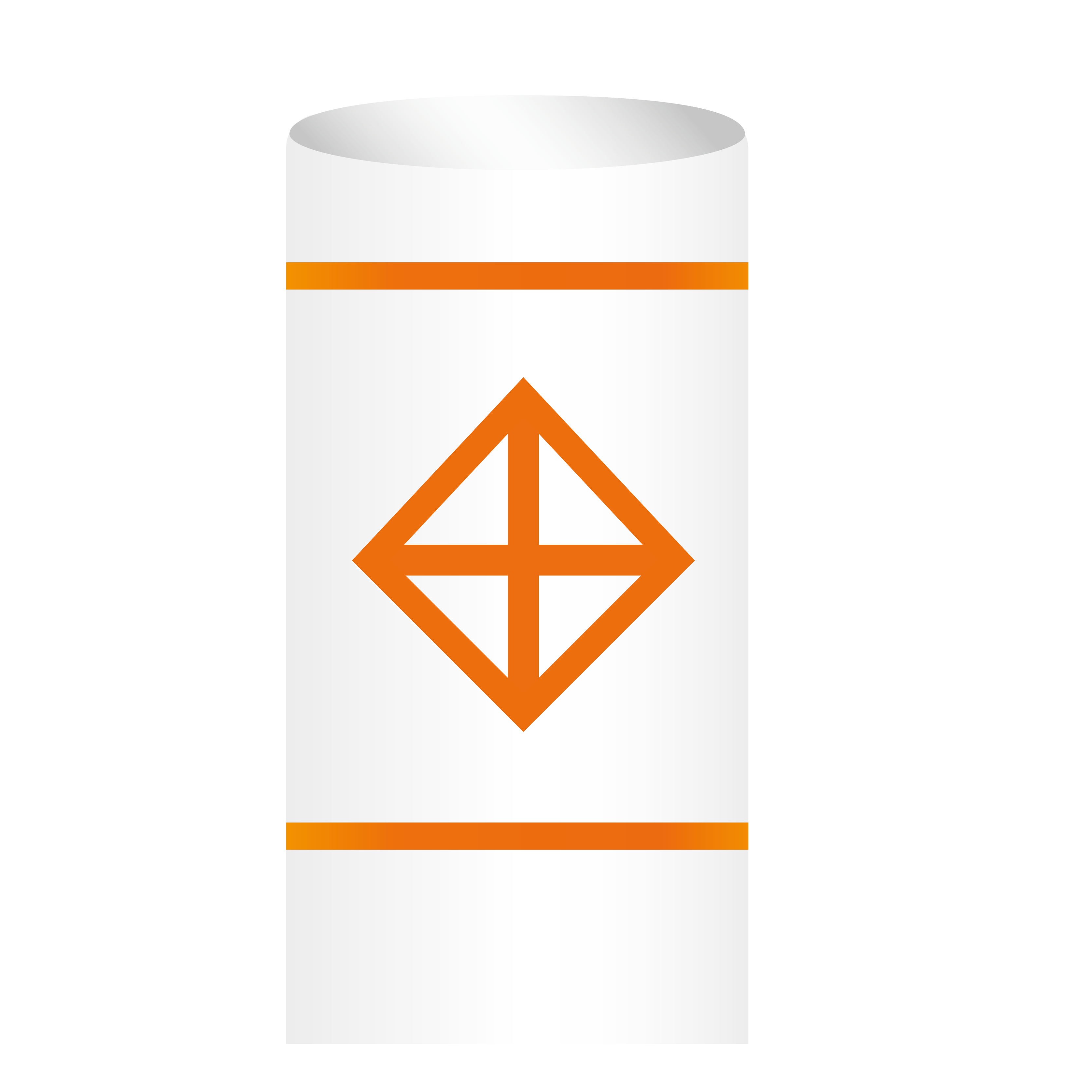 | |
|---|---|---|---|---|
| Meaning | Notes speed limits, wash restrictions, and other limitations | Notes a hazard such as a shoal or a rock that are usually in the middle of or surrounded by navigational waters | Share local information like campsite, marina, etc. | Designates area where boats area that prohibits entry |
| Body color | White with limitation indicated in orange circle in between two orange bars | White with orange diamond in between two orange bars | White with orange square in between two orange bars | White with orange diamond with cross at the middle in between two orange bars |
| Shape | Mostly cylinder | Mostly cylinder | Mostly cylinder | Mostly cylinder |
| Light color | Yellow when equipped | Yellow when equipped | Yellow when equipped | Yellow when equipped |
| Light Rhythm | Any rhythm not used for white light | Any rhythm not used for white light | Any rhythm not used for white light | Any rhythm not used for white light |
| Markings | With restrictions/limits information inside the orange circle | Danger can be pointed out inside the orange diamond | Information inside the orange square | none |
Diving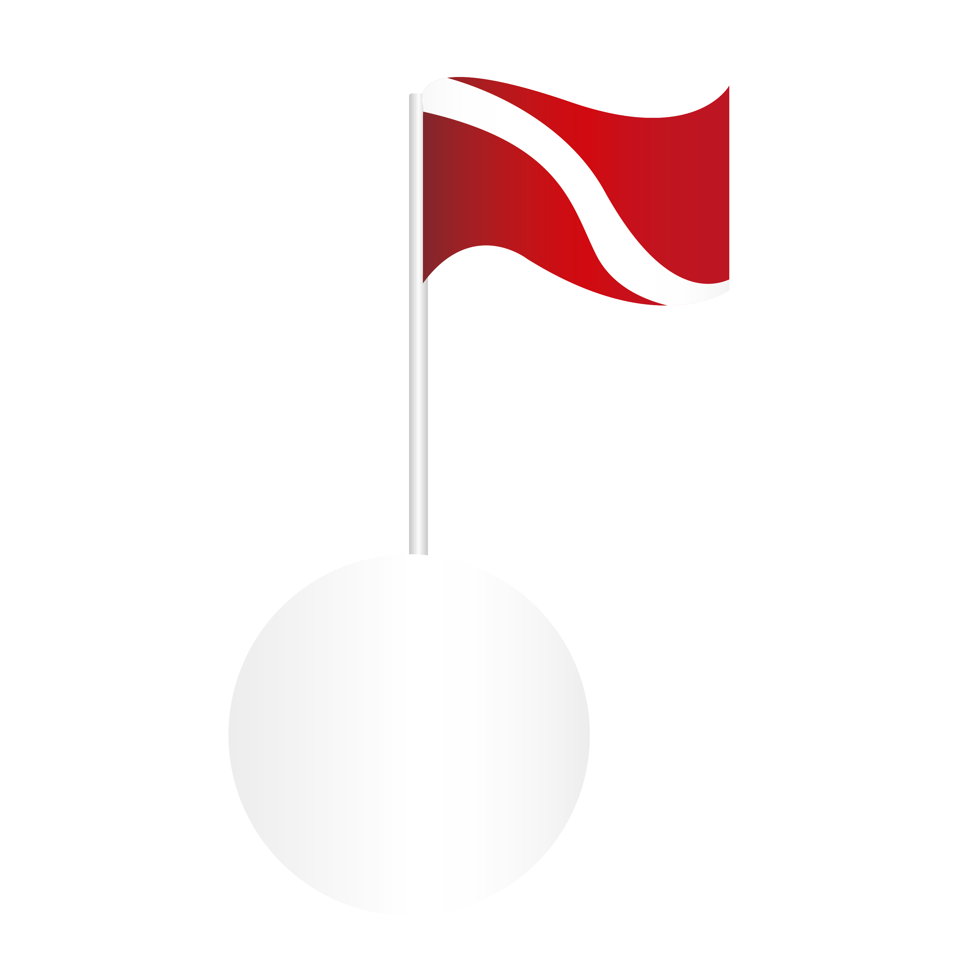 | Mooring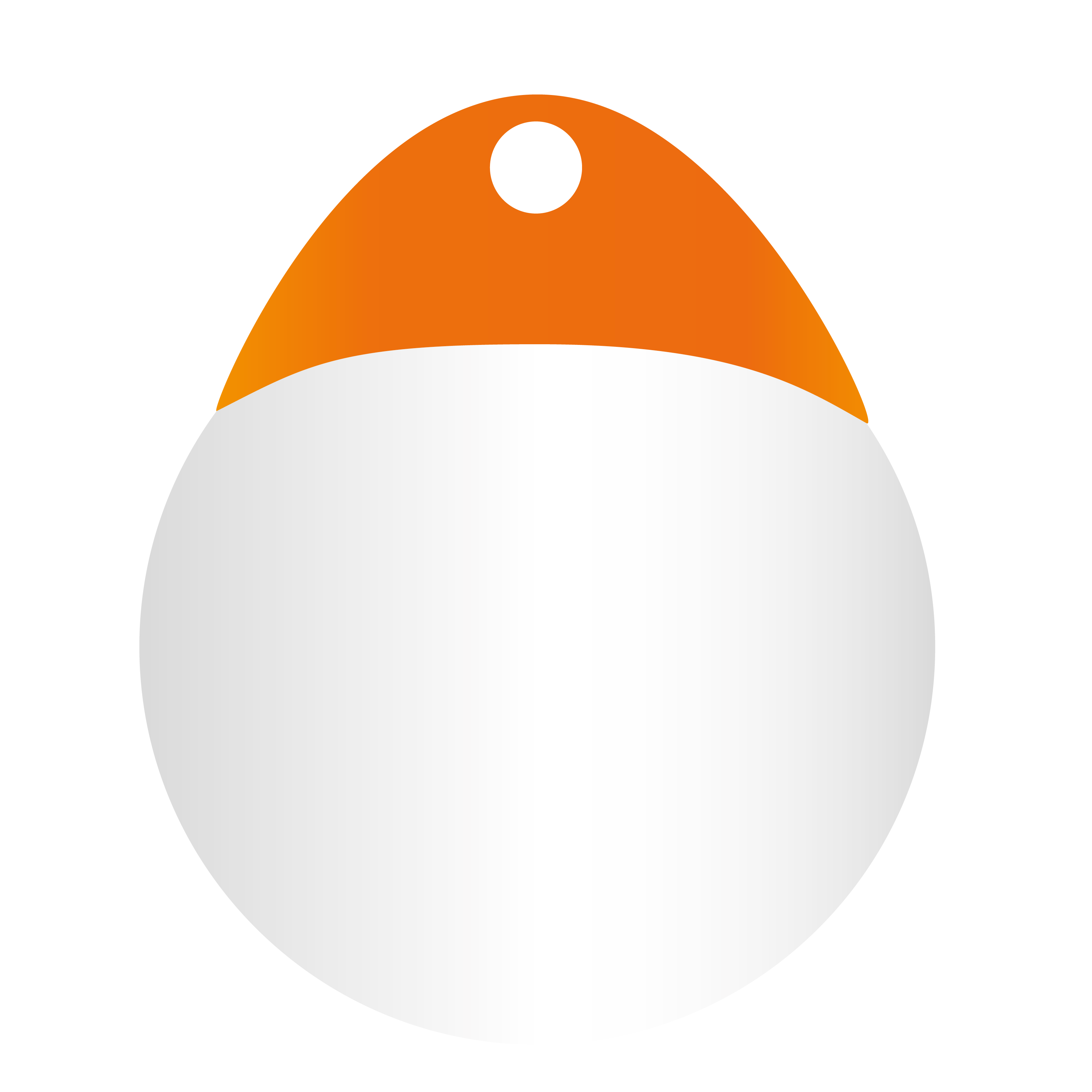 | Scientific/ Ocean Data Acquisition System (ODAS)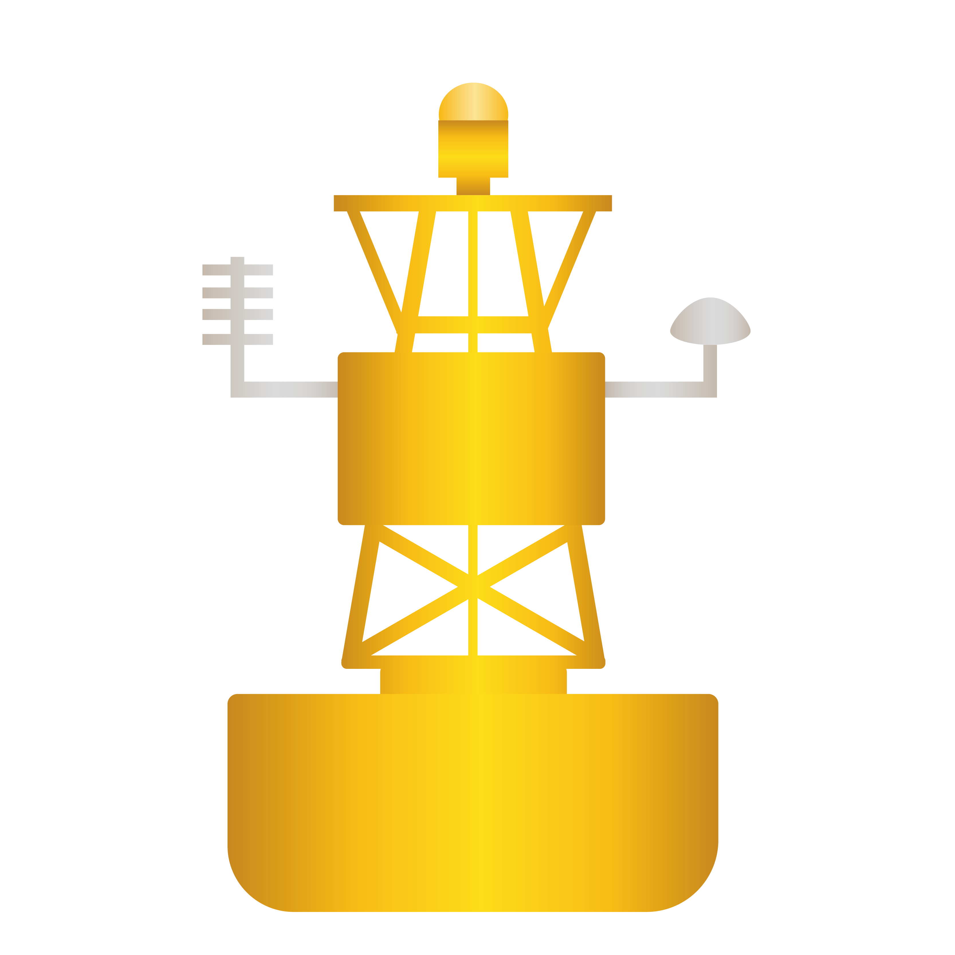 | Swimming buoy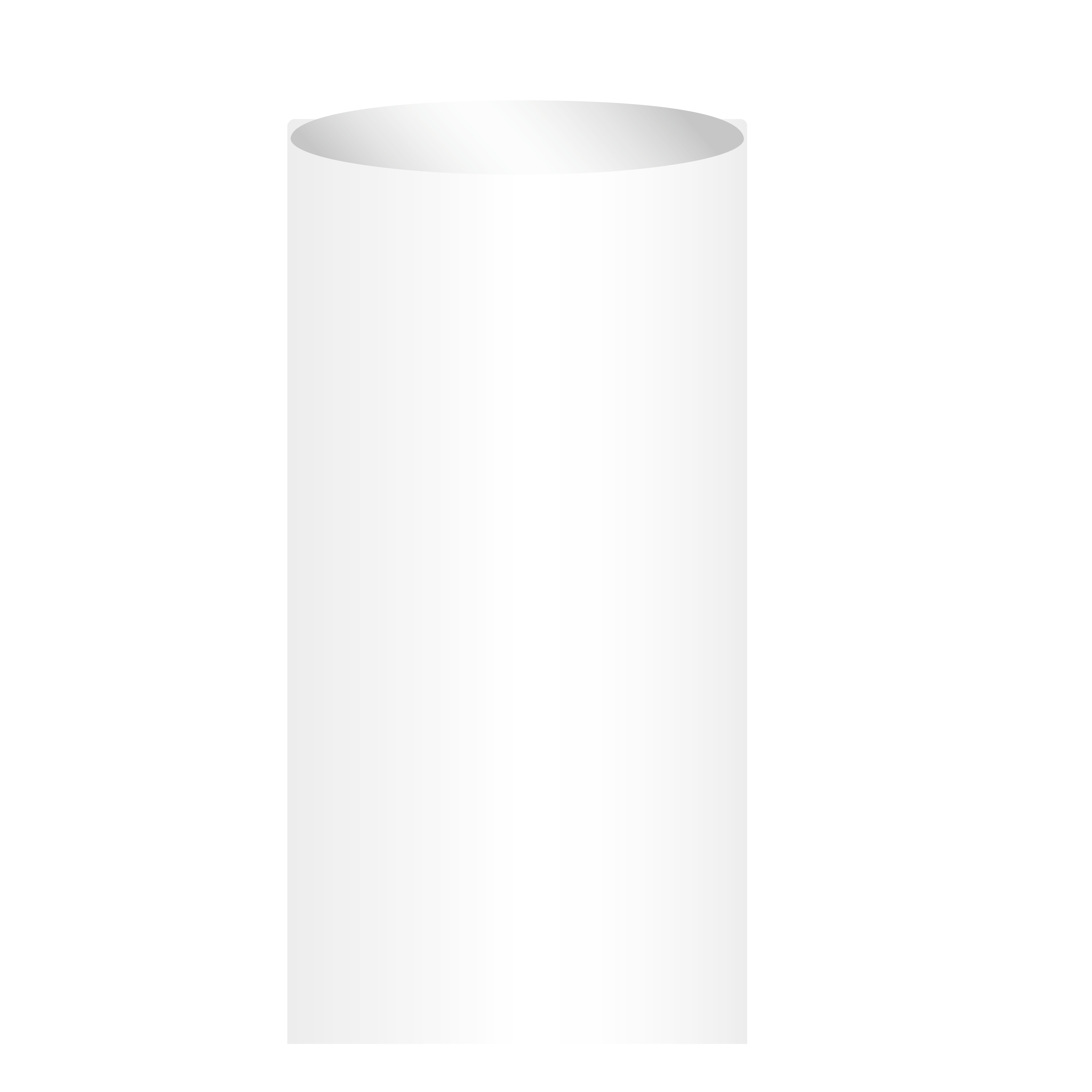 | |
|---|---|---|---|---|
| Meaning | Marks location where diving occurs and boaters should steer clear the area to avoid accidents | Notes place where boats may tie off to dock, other boats may be in the area so speed limit should be reduced | Buoys that record data such as weather, water temperature, currents, etc. therefore should keep distance from this buoy | Marks a swimming area and boats are not permitted to enter |
| Color | Any | Typically white with orange cap on the top | Yellow | White |
| Shape | Any | Any | Any | Mostly cylindrical tied on a rope |
| Top Mark | Red flag with white diagonal stripe | Usually has a sphere top mark | None | None |
| Light | None | None | Yellow when equipped; flashes 5 times in 25 seconds | None |
Just like the buoyage system, there is a standardized system for communications using nautical flags. The International Code of Signals (ICS) is used by marines and other boaters around the world for easy communication.
Its main goal is to prevent any misunderstanding which may arise from language barriers like meaning, spelling, and diction.
Nautical Flags
Even though we already have radio and other electronic devices available to easily communicate with other boaters, a lot still use nautical flags. The reason being that they are cheap and very reliable as they do not need power to be operated.
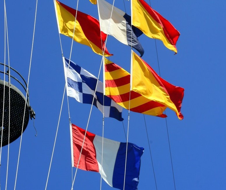
These are colorful flags that are used to signal other boaters just like our head and rear lights when we want to turn or change lanes on the road. However, reading nautical flags can be very confusing at the beginning as there are a lot of flags each corresponding to a letter and a specific meaning, compared to just left and right in cars.
How to Read Nautical Flags
The easiest way to read nautical flags is to look closely on their designs and meanings. Remember that nautical flags only use five colors: black, blue, red, white, and yellow. Shapes are very important as well, square/rectangular flags are used for letters, while pennant flags (triangular with flat tip) are numbers.
Below are the square flags, alphabets they represent and what they mean.
| Flag | Name | Letter | Meaning |
|---|---|---|---|
 | Alpha | A | Keep clear, diver is down. |
 | Beta | B | With dangerous cargo. |
 | Charlie | C | Yes. |
 | Delta | D | Keep clear, trying to move. |
 | Echo | E | Changing course to starboard. |
 | Foxtrot | F | I am disabled. |
 | Golf | G | Seeking a pilot. |
 | Hotel | H | Pilot on board. |
 | India | I | Changing course to port. |
 | Juliet | J | Burning vessel, keep away. |
 | Kilo | K | Need to communicate with you. |
 | Lima | L | Stop vessel immediately. |
 | Mike | M | Vessel is stopped. |
| Flag | Name | Letter | Meaning |
|---|---|---|---|
 | November | N | No. |
 | Oscar | O | Man overboard/out. |
 | Papa | P | Vessel about to sail. |
 | Quebec | Q | Permission to pass through. |
 | Romeo | R | Turn back. |
 | Sierra | S | Engines going astern. |
 | Tango | T | Stay away. |
 | Uniform | U | Approaching danger zone. |
 | Victor | V | Need help. |
 | Whiskey | W | Need medical attention. |
 | X-Ray | X | Stop what you’re doing. |
 | Yankee | Y | I am dragging my anchor. |
 | Zebra | Z | Need a pull. |
Numbers in Flags
There are 10 flags that represent numbers. Two or more digit numbers can be represented by combining these flags.
| Flag | Number |
|---|---|
| 1 | |
| 2 | |
| 3 | |
| 4 | |
| 5 |
| Flag | Number |
|---|---|
| 6 | |
| 7 | |
| 8 | |
| 9 | |
| 0 |
Flying the Flags
Aside from each flag’s meaning discussed above, boats can fly combinations of flags up to seven flags in a row, which will then mean differently.
For example, if you see a solo D (Delta) flag, this means “keep clear, trying to move” and a solo V (Victor) flag, this means “need help.” However, the combination of D (Delta) and V (Victor) flags, will mean “I’m maneuvering with difficulty and require assistance.” Another, a solo J (Juliet) meaning “burning vessel, keep away” and q solo L (Lima) meaning “stop vessel immediately.” Together, these flags mean “you’re running the risk of going aground.”
As a general rule, signals with two nautical flags mean some type of distress or maneuvering issue. Three or more flags can include pennants and denote things like points of the compass, geographical signals, names of ships, time and position, as well as latitude and longitude.
Buoys and nautical flags can be really overwhelming at the beginning, that’s why we have prepared a 2-page PDF that you can download here and print to have a cheat sheet while on the water! With more opportunities of sailing and seeing these buoys and flags, you will surely be familiar with them in no time!
Also, if you find this article useful, please let us know by commenting below!