Think of boating buoys and markers as the road signs of the water. Getting a handle on what they mean is your first step toward navigating safely and with confidence. The entire system is built on a simple visual language of colors, shapes, and numbers.
This straightforward language guides you through channels and warns you of hazards. All boaters, from seasoned captains to weekend warriors, need to understand it.
Your Quick Guide to Reading the Waterways
At first glance, a busy channel might look like a confusing mess of floating markers. But there’s a clear logic to it all. These aids to navigation (ATONs) are placed to keep you from running aground or into trouble.
Their job is to give you vital information at a glance. By learning to read them, you can easily identify safe passages and steer clear of hidden dangers. A little knowledge here goes a long way in making a waterway feel predictable.
Before we get into the details, let's start with a simple cheat sheet. This table breaks down the most common buoys and what they’re telling you.
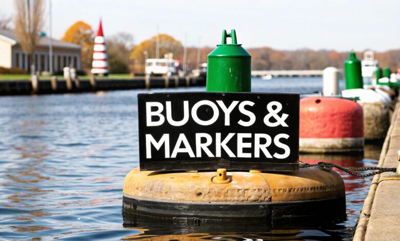
Quick Reference for Common Buoy Meanings
| Buoy Type | Primary Color(s) | Shape | Core Meaning |
|---|---|---|---|
| Lateral Marker | Red or Green | Can or Cone (Nun) | Marks the edges of a safe water channel. |
| Safe Water Marker | Red & White Stripes | Spherical or Pillar | Indicates open, unobstructed water. |
| Danger Marker | Black & Red Bands | Varies | Marks an isolated danger with safe water all around it. |
| Regulatory Marker | White with Orange | Varies | Communicates rules like "No Wake" or speed limits. |
Keep this table in mind as we dive deeper. Recognizing these markers will soon become second nature.
The Global Language of Navigational Aids
The buoys and markers you see aren't placed randomly. They’re part of a highly organized, universal language designed to keep boaters safe. Every skipper needs to speak it fluently.
This system is governed by the International Association of Marine Aids to Navigation and Lighthouse Authorities (IALA). They ensure a boater from Florida can understand the same markers as one in the Mediterranean.
Misinterpreting a buoy can have serious consequences. Knowing you're following a proven, global standard is the first step toward confident navigation.
Two Regions, One System
To make this global system work, the IALA split the world’s waterways into two regions. These are known as Region A and Region B.
The United States, along with the Americas, Japan, and the Philippines, falls into Region B. The rest of the world, including Europe and Africa, uses Region A.
Knowing which region you're in is absolutely critical. It prevents you from misreading a channel and running into trouble.
Most markers are identical between them, but there's a key difference. They use red and green buoys differently to mark channel sides. You can learn more in our ultimate guide to buoys and flags.
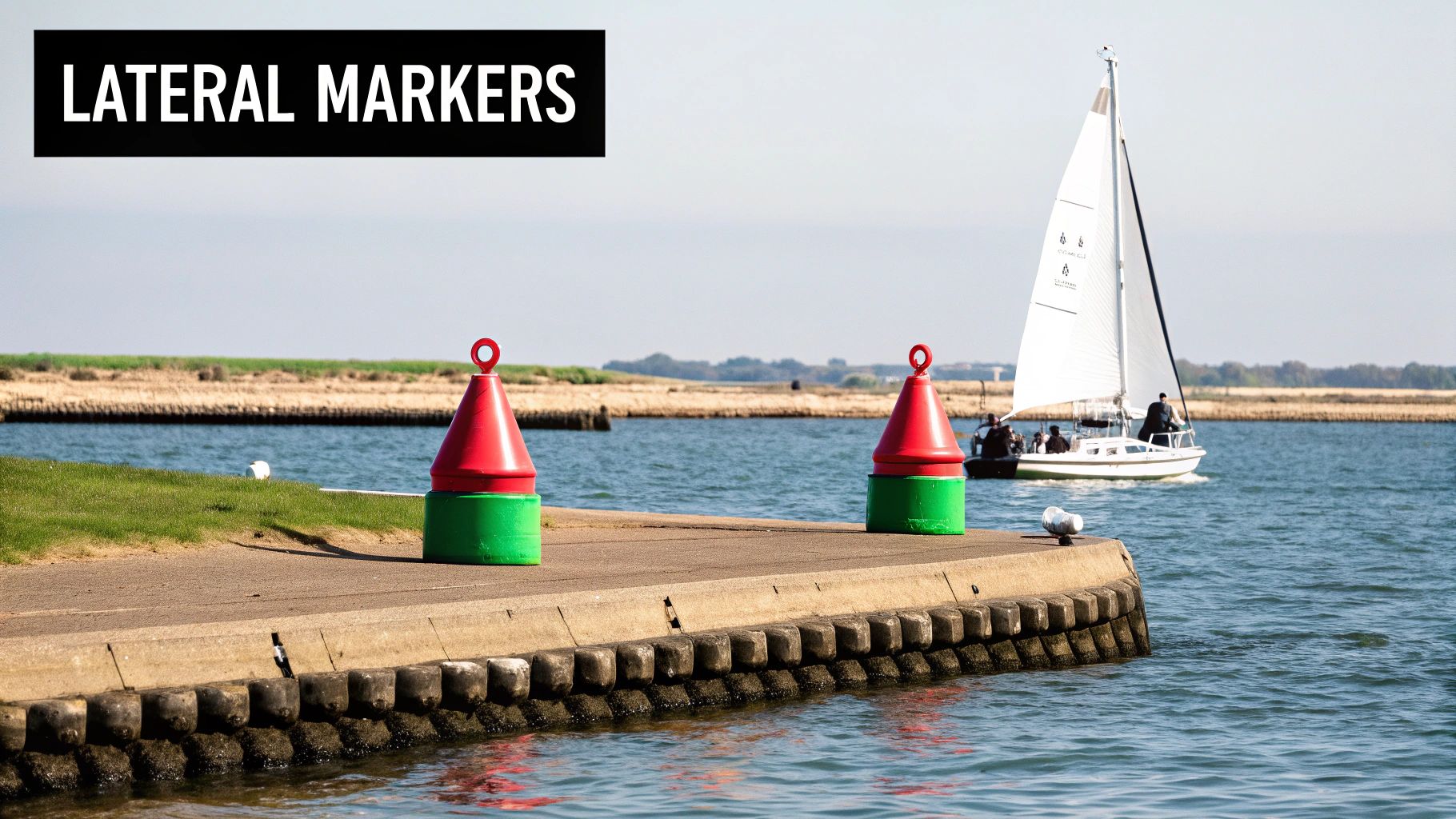
Decoding the Red and Green Channel Markers
The classic red and green buoys are the most common navigational aids. Think of them as the lines on a highway, guiding you through safe channels. Mastering them is a big step to navigating with confidence.
The trick to remembering which side is which in U.S. waters is a classic boater’s phrase: “Red, Right, Returning.”
This means when you're heading back to port from open water, keep the red markers on your right (starboard) side. It’s a simple rule that will keep you in the safe part of the channel.
Port and Starboard Channel Markers
The system goes a bit deeper than just color. These markers also use distinct shapes and numbers to give you more information.
Green markers are on your left (port) side when returning. They are often can-shaped and will always have odd numbers.
Red markers are for your right (starboard) side when returning. They are cone-shaped, often called "nuns," and always display even numbers.
For a quick reference on the water, here’s a simple breakdown of the lateral markers. This applies to the U.S. and other Region B areas.
Lateral Buoy Quick Identification Chart (IALA Region B)
| Feature | Port Side Buoy (Left) | Starboard Side Buoy (Right) |
|---|---|---|
| Color | Green | Red |
| Shape | Can (Cylindrical) | Nun (Cone-shaped) |
| Numbering | Odd | Even |
| Light | Flashing Green (FL G) | Flashing Red (FL R) |
| Returning | Keep to your port (left) | Keep to your starboard (right) |
Memorizing this table will make identifying your position in a channel second nature. These lateral markers are the backbone of the waterway system.
While "Red, Right, Returning" is key, there are many other signs. For a complete rundown, see our guide where boat navigation signs are explained.
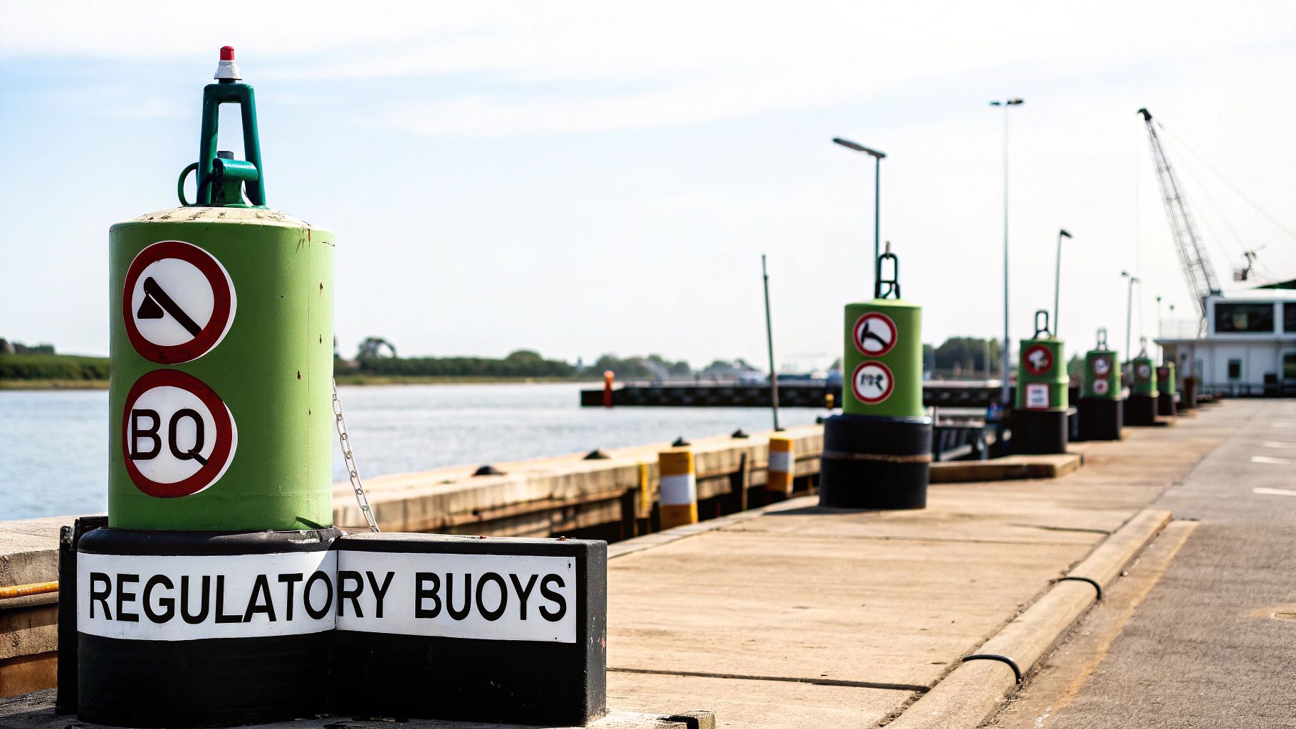
Understanding Informational Markers
Beyond the red and green channel markers, you'll find non-lateral markers. They are just as important for safe boating.
Think of them less like lane dividers and more like informational road signs. Their job is to give you a heads-up about what's going on in a specific area.
For instance, a white buoy with an orange circle is a floating "No Wake" sign. An orange square might point toward a public boat ramp or give directions.
The Most Common Informational Buoys
You'll quickly learn to recognize these markers by their distinct colors and symbols. Each one has a specific job.
Here are the big ones you'll see most often:
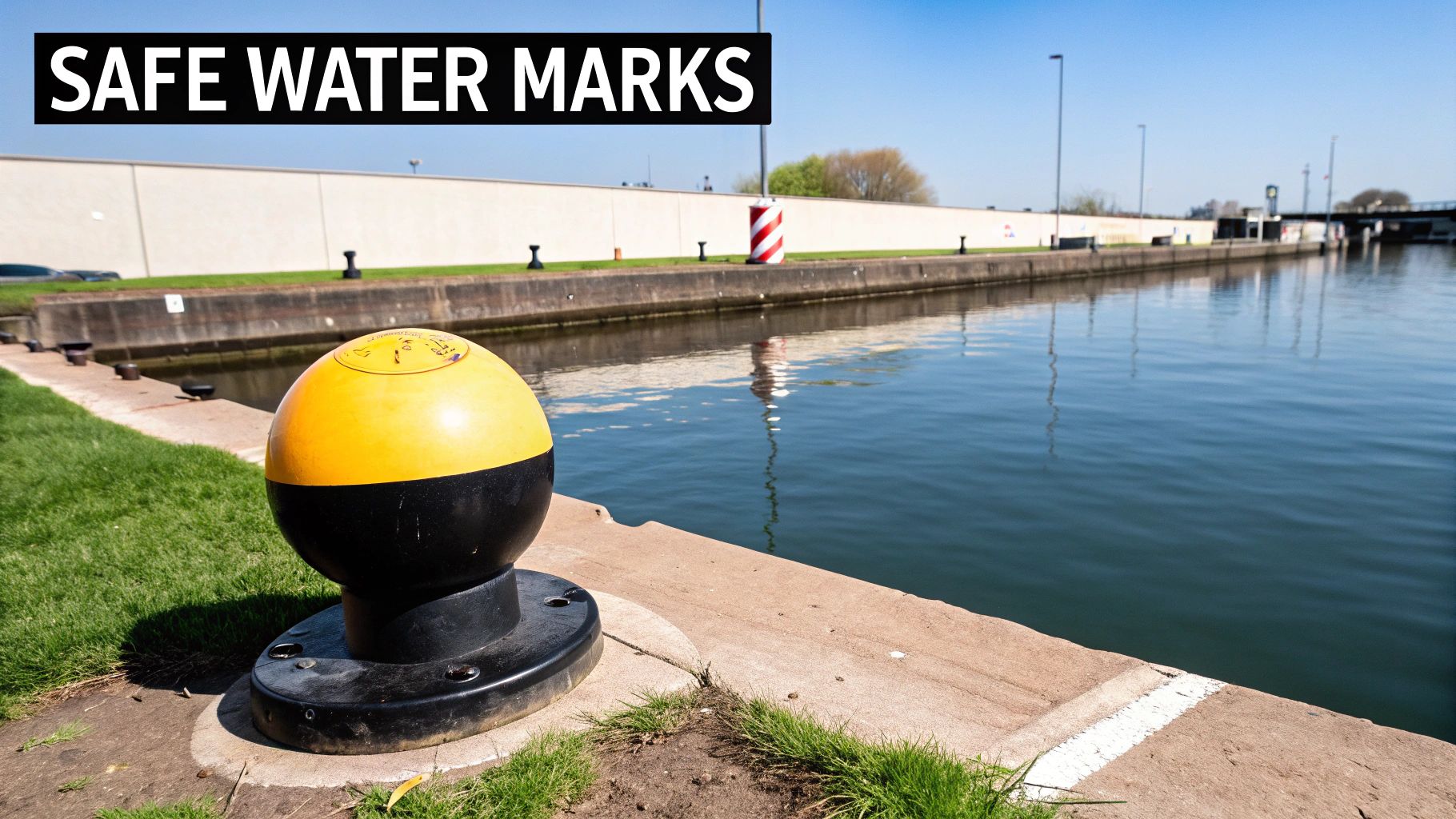
- Safe Water Markers: These are painted with bold red and white vertical stripes. Seeing one means you're in open, deep water with no hidden dangers nearby.
- Special Purpose Buoys: A solid yellow buoy is a signal to check your chart. They can mark underwater cables, pipelines, or dredging areas.
- Mooring Buoys: Typically white with a blue horizontal band, these are the only buoys you can legally tie your boat to.
The role of buoys has grown beyond simple navigation. Mooring buoys make up 27.3% of the global market, a segment valued at $251.5 million in 2024. For more details, see the global data buoy market on fortunebusinessinsights.com.
Navigating with Cardinal and Safe Water Markers
Once you've got the hang of channel markers, two other types are essential. One of the best sights is a Safe Water Marker. These buoys, painted with red and white vertical stripes, are the "all clear" signal.
They tell you that you're in open, deep water with no hidden surprises. You'll often spot them marking the seaward entrance to a channel. You can safely pass them on either side.
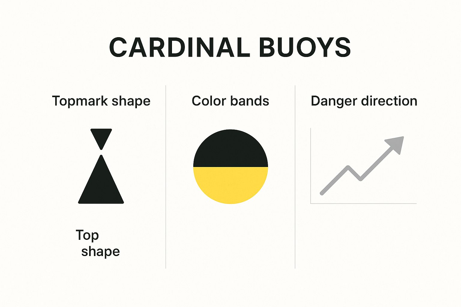
Understanding Cardinal Buoys
Cardinal Buoys are a bit more sophisticated. They point you toward the safest water in relation to a specific hazard. They tell you which compass direction—North, South, East, or West—to go to steer clear of an obstruction.
Each Cardinal Buoy uses a pattern of black and yellow bands, plus two cones on top, to signal the safe direction. A North Cardinal Buoy tells you to pass on its north side to avoid the hazard.
Getting these down is a massive part of being a responsible skipper. For more, see the ultimate guide to navigation rules. Understanding these markers helps you make confident decisions on the water.
Common Questions About Buoy Meanings
Even after you learn the basics, real-world situations bring up questions. Getting these answers straight turns knowledge into instinct.
This section covers the most common questions from boaters. It will help you make smart, safe decisions without hesitation.
What Is the Most Important Rule for Buoys in the US?
If you only remember one thing, make it this: "Red, Right, Returning." This phrase is the bedrock of safe channel navigation in the United States (IALA-B system).
It's simple. When returning from sea or heading upstream, keep the red, cone-shaped "nun" buoys on your right-hand (starboard) side. This means the green, can-shaped buoys will be on your left (port) side.
How Do Buoy Meanings Work at Night?
The rules don't change at night, but your identification methods do. At night, you navigate by lights, not by the buoy's color or shape.
Each lighted buoy has a distinct flashing pattern and color. A red lateral marker will have a flashing red light, and a green one will flash green.
Navigating by lights is a skill all its own. You must match the flashes you see with the symbols on your nautical chart to be sure of where you are.
What Should I Do If a Buoy Is Missing or Moved?
First, slow down and proceed with extreme caution. Buoys can be dragged off-station by severe weather or a collision. Never bet your safety on a single aid.
If you suspect a buoy is out of place, use other tools. Cross-reference your position using your GPS, charts, and depth sounder to find safe water.
The most important step is to report it. Get on VHF Channel 16 and report the issue to the U.S. Coast Guard.
At Boating Articles, we provide the expert guidance you need to navigate with confidence. From understanding every buoy to mastering docking techniques, find clear, practical advice at https://boating-articles.com.